In a world where precision is paramount, technology like Lidar stands out as a game-changer in the field of surveying and mapping. But what exactly is Lidar scanning, and why is it gaining so much attention, especially in New Jersey? If you’re involved in construction, urban planning, or environmental management, understanding Lidar scanning could be the key to unlocking new levels of accuracy and efficiency in your projects.
Understanding Lidar Scanning
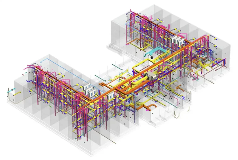
Lidar, which stands for Light Detection and Ranging, is a remote sensing method that uses laser pulses to measure distances. Lidar can create highly accurate 3D models of the environment by calculating the time it takes for a laser to bounce back from a target. This process is known as Lidar 3D scanning and is increasingly being used across various industries for detailed mapping and analysis.
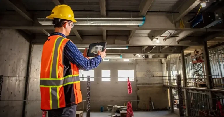
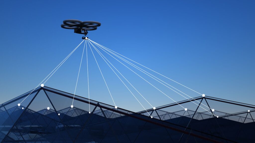
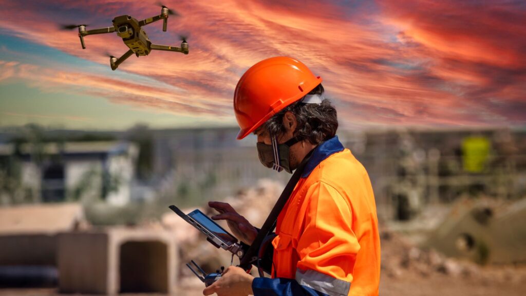
The core components of a Lidar system include a laser, scanner, GPS receiver, and inertial measurement unit (IMU). These components work together to collect data points, known as point clouds, which are then processed into 3D models. Whether used on the ground or in the air through drone Lidar scanning, this technology provides unparalleled detail and accuracy. It is especially valuable for projects in New Jersey’s diverse landscapes.
Why Lidar Scanning Matters
Lidar scanning isn’t just another surveying tool—it’s a revolution in how we gather and interpret spatial data. Here’s why it’s important:
- High Precision: Lidar offers centimeter-level accuracy, far surpassing traditional surveying methods.
- Efficiency: It can cover large areas quickly, making it ideal for extensive land surveys or infrastructure projects.
- Versatility: Lidar is effective in various environments, from dense forests to urban landscapes.
These features make Lidar an invaluable tool in modern surveying, construction, environmental monitoring, and more, particularly in the diverse terrains of New Jersey.
Key Applications of Lidar Scanning
Lidar is not limited to a single industry. Its applications are vast and varied:
- Land Surveying and Mapping: Lidar is used to create detailed topographical maps, which are crucial for planning construction projects and infrastructure development, especially in New Jersey’s urban and suburban areas.
- Environmental Monitoring: From tracking deforestation to monitoring coastal erosion, Lidar scanning provides the data needed to manage natural resources effectively in New Jersey.
- Urban Planning: Cities across New Jersey use Lidar data to design and manage infrastructure, utilities, and public safety initiatives.
- Historical Preservation: Lidar helps in documenting and preserving historical sites and structures, providing a non-invasive way to gather detailed information across New Jersey’s rich historical landscapes.
These applications highlight how Lidar services are transforming how we approach both large and small-scale projects, particularly in a state as diverse as New Jersey.
The Advantages of Lidar Scanning Over Traditional Methods
Why choose Lidar over traditional surveying methods? The benefits are clear:
- Greater Accuracy: Lidar provides more precise measurements, reducing the margin of error significantly.
- Time Efficiency: Lidar can scan large areas in a fraction of the time it would take with traditional methods.
- Cost-Effective: While the initial investment in Lidar technology may be higher, the long-term savings in time and labor make it a cost-effective choice.
- Enhanced Safety: Lidar can be used in hazardous or hard-to-reach areas, reducing the risk to surveyors.
These advantages make Lidar scanning a preferred choice for professionals in New Jersey looking for reliable, efficient, and accurate data collection methods.
Challenges and Considerations
Despite its many advantages, Lidar scanning does come with some challenges:
- Initial Costs: The equipment and software needed for Lidar can be expensive, though the return on investment often justifies the cost.
- Data Processing: The vast amount of data generated by Lidar requires powerful software and skilled technicians to process and interpret.
- Weather Sensitivity: Lidar’s accuracy can be affected by weather conditions such as rain, fog, or heavy vegetation, which may interfere with the laser pulses.
Understanding these challenges can help you make informed decisions about when and how to use Lidar services effectively, especially in New Jersey’s varied climate.
The Future of Lidar Scanning

As technology advances, so too does the potential of Lidar scanning. With ongoing improvements in sensor technology and data processing, Lidar is becoming more accessible and versatile. The integration of Lidar with drones has opened up new possibilities for aerial surveying. It is easier to capture data in remote or difficult-to-access areas in New Jersey.
Lidar scanning is particularly promising for applications like agriculture. It can be used to monitor crop health and optimize resource usage. As industries across New Jersey continue to adopt Lidar, we can expect to see even more innovative uses emerge.
Conclusion
Lidar is a powerful tool that’s reshaping industries from construction to environmental management. Whether you’re involved in land surveying, urban planning, or historical preservation in New Jersey, understanding Lidar scanning can help you achieve greater accuracy and efficiency in your work.
Ready to see how Lidar scanning can transform your next project? Contact FirstLook Services today to learn more about our comprehensive Lidar services, right here in New Jersey.